San Francisco geographical oddity
January 21, 2016 11:39 AM Subscribe
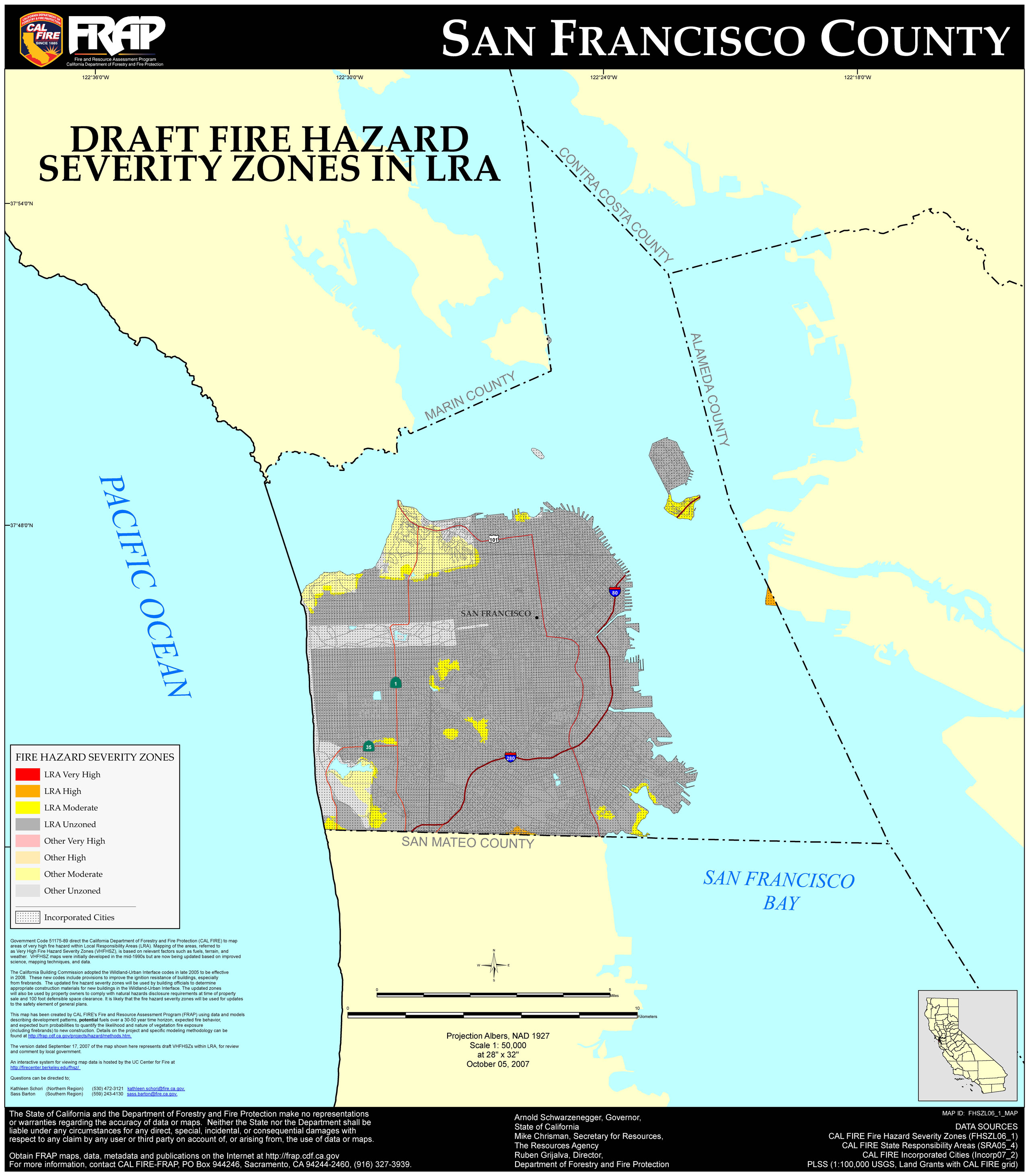
If you search Google Maps for "San Francisco", it shows tiny corners of Angel Island and Alameda Island as lying within city limits. Is this accurate? If so, how did the city/county boundary lines get drawn in such an unusual way?
It's accurate. Drawing the city limits based on fixed locations you can see and survey and triangulate from (the tip of an island) makes a lot more sense to me than basing it on something arbitrary and imaginary that you can't see/survey (eg half a mile into the harbour from the outermost shoreline at high king tide?), so it strikes me as a sensible and practical way to draw borders, rather than unusual.
posted by anonymisc at 11:48 AM on January 21, 2016 [1 favorite]
posted by anonymisc at 11:48 AM on January 21, 2016 [1 favorite]
From the Angel Island Wiki:
The island is almost entirely in the city of Tiburon, in Marin County, although, there is a small sliver (0.7%) at the eastern end of it (Fort McDowell) which extends into the territory of the City and County of San Francisco.
posted by humboldt32 at 11:48 AM on January 21, 2016
The island is almost entirely in the city of Tiburon, in Marin County, although, there is a small sliver (0.7%) at the eastern end of it (Fort McDowell) which extends into the territory of the City and County of San Francisco.
posted by humboldt32 at 11:48 AM on January 21, 2016
Fun fact: the Farallon Islands, 30 miles offshore, are also part of San Francisco.
posted by gyusan at 11:53 AM on January 21, 2016 [2 favorites]
posted by gyusan at 11:53 AM on January 21, 2016 [2 favorites]
Best answer: The city/county limits of San Francisco extend far beyond the main landmass of the city, hugging the coastline of Marin, going over to the corner of Angel Island, then shooting all the way up to Red Rock Island, close to the Richmond-San Rafael Bridge. Why they do that, though, is something I've never been able to figure out.
posted by zsazsa at 12:27 PM on January 21, 2016
posted by zsazsa at 12:27 PM on January 21, 2016
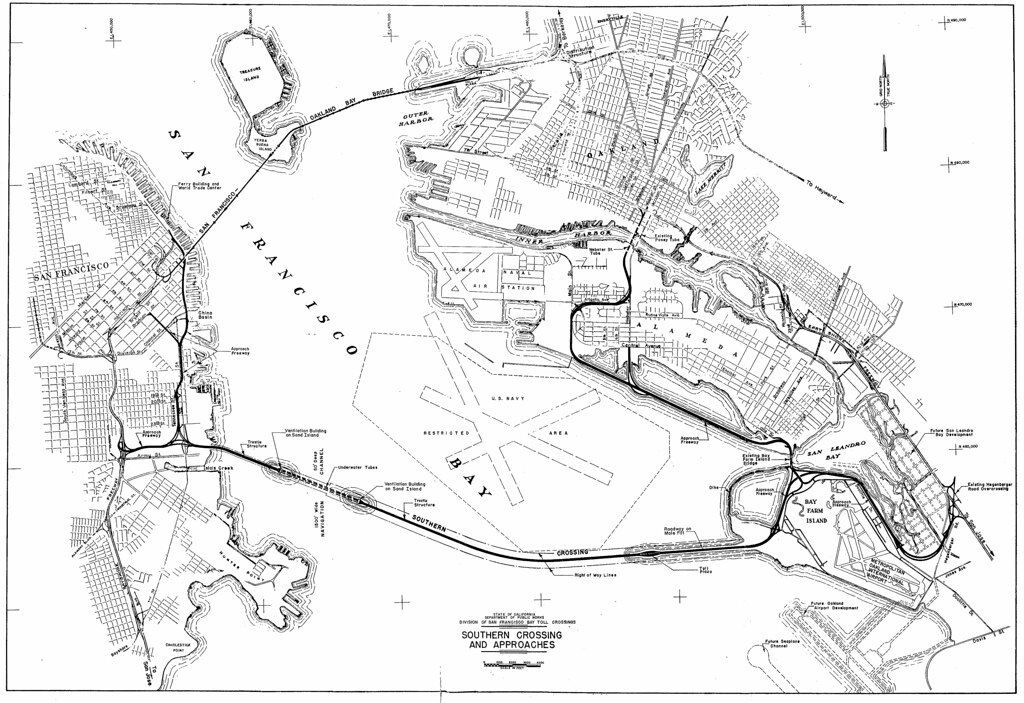
Kind of a shot in the dark, but could the Alameda one at least have been for a ferry or in preparation of a future bridge? I figure it'd be easier to run a ferry/build a bridge that was all in one county/city than having to deal with two separate counties/bridges.
posted by Elly Vortex at 12:50 PM on January 21, 2016
posted by Elly Vortex at 12:50 PM on January 21, 2016
The SFO airport is also part of the city, even though it's 13 miles south and not attached in any way.
posted by foodgeek at 1:03 PM on January 21, 2016 [1 favorite]
posted by foodgeek at 1:03 PM on January 21, 2016 [1 favorite]
Kind of a shot in the dark, but could the Alameda one at least have been for a ferry or in preparation of a future bridge?
There was indeed going to be another bridge between Cesar Chavez (Army) and Oakland, but the terminus would have been at the other end of the island.
I've never seen these pieces of SF scattered about before, maybe there's a data error or some military connection.
posted by rhizome at 2:40 PM on January 21, 2016
Parts of Yosemite near Lake Vernon are actually San Francisco too; cabins built in the 1940s to support maintenance at Hetch Hetchy. Here's a map showing the border. The exact definitions of "part of San Francisco" here are a bit squishy, this article gets in to some of the details.
posted by Nelson at 3:35 PM on January 21, 2016 [2 favorites]
posted by Nelson at 3:35 PM on January 21, 2016 [2 favorites]
That bit of alameda is almost certainly fill. When the boundaries were set, the area was either tidal salt marsh or fully under water.
posted by rockindata at 4:25 PM on January 21, 2016
posted by rockindata at 4:25 PM on January 21, 2016
Best answer: From the Atlas of Historical County Boundaries (pg. 212 in the California pdf):
Between 1949 and 1959 (precise date unknown) SAN FRANCISCO gained a small area of the Alameda Naval Air Station when landfill expansion extended westward over the county line between SAN FRANCISCO and ALAMEDA in San Francisco Bay.posted by mhum at 5:07 PM on January 21, 2016 [4 favorites]
U.S.G.S., 7.5 Minute Series, Oakland West Quadrangle, "Edition of 1949" and "Edition of 1959"
Gotta say: the City and County of San Francisco may own land and water rights, etc. within Hetch Hetchy -- Yosemite National Park -- but I very much doubt that isn't still Tuolumne County.
posted by lathrop at 6:18 PM on January 21, 2016 [1 favorite]
posted by lathrop at 6:18 PM on January 21, 2016 [1 favorite]
Response by poster: Interesting points. It makes sense that the bit of Alameda Island in SF County is landfill; I wonder if the point of land that Fort McDowell sits on is landfill as well.
The fact that most of the water boundaries of SF County are straight lines makes a certain amount of sense as well. However, not all of the points that the lines are drawn between seem to be easily measurable points; the tripoint between San Francisco, Contra Costa, and Alameda counties appears to be nothing but water, and there's a weird jog in the border between San Francisco and Alameda counties just to the east of Treasure Island. It's also not clear why SF County's water borders go all the way north to Red Rock. It'd be interesting to see a complete historical account of how the bay area counties got their shapes, but perhaps such a history does not exist.
posted by Johnny Assay at 11:46 AM on January 22, 2016
If there are jogs in the border in the middle of the bay, I'd probably take a look at maps of shipping lanes, which are famously constrained.
posted by rhizome at 12:24 PM on January 22, 2016
posted by rhizome at 12:24 PM on January 22, 2016
« Older How do I end two relationships in a positive note? | Job Hunting in a Cultural Field Newer »
This thread is closed to new comments.
posted by jferg at 11:44 AM on January 21, 2016