What are the most data-rich, detailed weather apps for weather geeks?
December 11, 2019 2:27 PM Subscribe
Algorithms that supposedly can tell you it'll rain in 20 minutes are not what I’m looking for. I’d rather glance at high-res radar imagery and make that judgement for myself. Yes, I’d like a good main screen with detailed current conditions and the typical 2-5 day forecast, but I’m especially interested in having access to lots of realtime data packaged in a clean, ad-free design with worldwide functionality. Assuming I’m willing to pay for a quality app on iOS, what would you recommend for someone like me? Wishlist below the fold:
- High-res radar and a variety of realtime satellite imagery such as visible hi-res (0.5 km), longwave IR, water vapor, etc.
- Easy access to NWS Area Forecast Discussions [like this] for US locations
- Good data for non-US locations and functionality worldwide
- Air-quality info
- Good privacy policies (weather apps are notorious for selling location data to third parties)
I've been using the official Environment and Climate Change Canada app WeatherCAN, which also ticks a bunch of these boxes but is, obvs, Canadian. It does have some international functionality that pulls in official national meteorological services data, though.
posted by mandolin conspiracy at 3:03 PM on December 11, 2019
posted by mandolin conspiracy at 3:03 PM on December 11, 2019
Ventusky (weather visualization) has a paid app ($2.99), (free desktop) . I don't know how good their privacy policy sounds to you, but it works for me, and I quite like the integration of various weather models and the ability to flip between them.
posted by larthegreat at 3:04 PM on December 11, 2019 [2 favorites]
posted by larthegreat at 3:04 PM on December 11, 2019 [2 favorites]
I just have lots of links to various pages, mostly NWS... some are pretty technical, I'm a pilot and these are the resources I use every day. I only look at US weather, though.
Arranged in order of freshness:
SF Bay NEXRAD
SF Bay near-realtime satellite
NorCal ATC shift summary
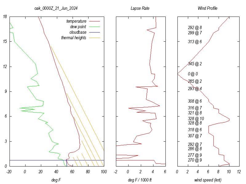
OAK sounding
Sierra Nevada soaring forecasts
North-Central CA Coast soaring forecast
NWS Forecast discussion (Monterey)
GOES-W+500mb
And of course lots of satellite imagery products at many wavelengths are available at aviationweather.gov.
You can probably click around and find equivalent pages for wherever you're located. None of these web pages ask for your personal information, and are all free. (I use an ad blocker.)
posted by phliar at 4:09 PM on December 11, 2019 [3 favorites]
Arranged in order of freshness:
SF Bay NEXRAD
SF Bay near-realtime satellite
NorCal ATC shift summary
OAK sounding
Sierra Nevada soaring forecasts
North-Central CA Coast soaring forecast
NWS Forecast discussion (Monterey)
GOES-W+500mb
And of course lots of satellite imagery products at many wavelengths are available at aviationweather.gov.
You can probably click around and find equivalent pages for wherever you're located. None of these web pages ask for your personal information, and are all free. (I use an ad blocker.)
posted by phliar at 4:09 PM on December 11, 2019 [3 favorites]
Best answer: The National Weather Service/NOAA is not allowed to create an app, since the powers that be determined it would be in competition with private companies. (I'm jealous of the Canadian app linked above) And yet no private company has a nice one stop shop for weather information that appeals to enthusiasts. Yet.
I do have a recommendation for a radar app though. Radarscope is kind of steep for an app (9.99) but provides great high resolution radar displays with quite a few of the options (Doppler, duel-polorization) that professional meteorologists get. Not quite worldwide, but it does have USA, Canadian, Australian, and South Korean radars.
If you want US NWS forecast discussions, you can pull those up in a more phone readable format on mobile.weather.gov. Just enter your location and it will bring up the forecast as well as a link to the local offices's discussion.
posted by weathergal at 2:05 AM on December 12, 2019 [2 favorites]
Windy (windy.com or download the app). You have to dig a little to get all the detail offered.
posted by SemiSalt at 6:46 AM on December 12, 2019 [1 favorite]
posted by SemiSalt at 6:46 AM on December 12, 2019 [1 favorite]
As a sailor, I have a keen interest in monitoring weather. My favorite app is RadarScope, which provides high resolution radar data, with reflectivity, velocity, phase, correlation and echo top data. They have a pro version which allows even cooler stuff, like lightning strike data and 30 day archives of most everything they display. Also consider subscribing to AllisonHouse, who do an amazing job of aggregating data from everywhere and would add things like the text forecasts and air quality that is missing from RadarScope, which focuses almost exclusively on imagery.
My weather guru is Mark Thornton at LakeErieWX.com and his site has lots of links to various detailed resources, if you don't find the first two suggestions to have what you need.
You can judge RadarScope's privacy policy for yourself here. Personally, I turn off location services when I use the app and it doesn't cause me any issues. It doesn't provide very good coverage of locations outside the US, which you had noted as important to you.
posted by Lame_username at 10:29 AM on December 12, 2019
Best answer: I am a minor weather nerd with a background in aviation and more recently sailing. I have used a lot of different sites and data sources over the years, primarily UK & European.
A couple of general points to be aware of:
- Data with high resolution (both spatial/temporal) and low delay, is highly commercially valuable. You should be expecting to pay a regular subscription fee if you really want this sort of thing.
- Availability, format & pricing of weather data is rather fragmented & inconsistent between different countries, which makes worldwide solutions for high-res, realtime data very limited and expensive. Providers that offer worldwide data are either spending a lot or compromising a lot. It's easier to provide a high-quality solution that's focused on a single area using local data sources.
So think quite carefully about what you actually need. If you're primarily US-based you may well probably find better and cheaper options for high-precision data if you focus on that.
For general worldwide use, I find Windy.com very good (iOS app). They have great visualisation of lots of parameters, and worldwide coverage at reasonable resolution, funded by donations and commercial users of their API. I use this a lot for a quick look at what's going on.
For more serious marine purposes, and for something I can grab and take to sea offline, I use a subscription to Theyr, which has both global and regional options.
In the UK, for flying I used RASP heavily, and for hillwalking, the Scottish MWIS. For live rainfall Rain Today is handy, and has a premium service with higher resolution & lower delay. All these are UK-specific things. You will probably find similar things local to other places, but not much in the way of worldwide options at those levels of detail.
posted by automatronic at 10:45 AM on December 12, 2019 [2 favorites]
Not an app, but you might enjoy earth.nullschool.net for wind, cloud etc visualisations.
posted by freethefeet at 1:45 PM on December 13, 2019
posted by freethefeet at 1:45 PM on December 13, 2019
« Older Smoothie kings and queens--what's your technique... | Using a Primary Care Physician Not Covered By Your... Newer »
This thread is closed to new comments.
posted by Jubey at 2:51 PM on December 11, 2019