Make many points on Google Maps
June 21, 2005 10:27 AM Subscribe
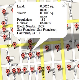
How do people create Google Maps with a lot of different points selected, like this? Is there an easy way to do this from the main Google Maps site or do you have to have some extra programming done? I'd really like to enter two or three addresses and mark all their points on the same map (without having to do directions, and thus the route between them).
Usually they do it with AJAX, which is a way of programming using XMLHTTP and JavaScript.
posted by matildaben at 11:06 AM on June 21, 2005
posted by matildaben at 11:06 AM on June 21, 2005
Is there an app out there that will let you type in a coordinate and then aggregate multiple maps to create a largish map, as one big jpg?
posted by mecran01 at 11:20 AM on June 21, 2005
posted by mecran01 at 11:20 AM on June 21, 2005
I asked a similar question a few weeks back and the answers were pretty similar.
posted by jessamyn at 12:27 PM on June 21, 2005
posted by jessamyn at 12:27 PM on June 21, 2005
There is a FAQ on the website you got that screengrab from, cjgregor. It explains the rudiments of the technologies used:
posted by bcwinters at 12:48 PM on June 21, 2005
Google maps using Javascript, XML, XSLT, and CSS to create a web application that behaves more like a desktop application. With normal web programming, the user is presented with a form, the user inputs data, the user submits the form, and finally the entire web page reloads with new content. AJAX, as this type of programming has been coined, does not require the reloading of the entire interface. The Javascript is able to make calls back to the server to get the required information and update only those parts of the interface that needs to change.Learning how to do things with the combination of technologies now known as AJAX seems like it would be super useful. But it's probably not easy if you don't already have programming knowledge, I would guess.
In the case of gCensus, every time the map is panned or zoomed the Javascript contacts the gCensus server and requests information for the viewable map region. At the same time, the Google code contacts the Google servers and requests the required images needed to display the map. The page is only reloaded when the user clicks the refresh button.
posted by bcwinters at 12:48 PM on June 21, 2005
The best resource for doing anything you can dream of with GoogleMaps: Google Maps Standalone Mode
posted by vjz at 1:16 PM on June 21, 2005
posted by vjz at 1:16 PM on June 21, 2005
Response by poster: So there's no trick like separating multiple addresses with "|" or anything to get them all to display, huh?
posted by clgregor at 2:18 PM on June 21, 2005
posted by clgregor at 2:18 PM on June 21, 2005
This thread is closed to new comments.
posted by cali at 10:40 AM on June 21, 2005