Where is the drainage divide of San Francisco?
August 1, 2012 10:22 AM Subscribe
Where is the drainage divide of San Francisco, separating areas of the city that drain to San Francisco Bay from those that drain directly to the Pacific Ocean?
The Wikipedia article on The Wiggle, a biking route in San Francisco, mentions that "After climbing 50 more feet, the peak of The Wiggle is reached near Stanyan Street at the peninsular drainage divide, i.e., the dividing point between surface water flowing to the San Francisco Bay on the east side and flowing to the Pacific Ocean on the west."
Is there a map anywhere indicating this drainage divide? Alternatively, if no such map exists, how could I figure out where that divide is myself? (I guess this extends down the Peninsula as well, but I don't care about the Peninsula.)
This is pretty close - it's a watershed map of the area - point and click your way around. As I understand it, the watershed boundaries are usually the highest areas between the two waterways, so a topo map might help you find the ridgeline between the bay and the ocean. There's also this nifty guide to the watersheds of the area.
posted by jquinby at 10:28 AM on August 1, 2012 [2 favorites]
posted by jquinby at 10:28 AM on August 1, 2012 [2 favorites]
Ah, also - the EPA has a great website called 'Surf Your Watershed'...here's the drill-down for the SFO area.
posted by jquinby at 10:30 AM on August 1, 2012
posted by jquinby at 10:30 AM on August 1, 2012
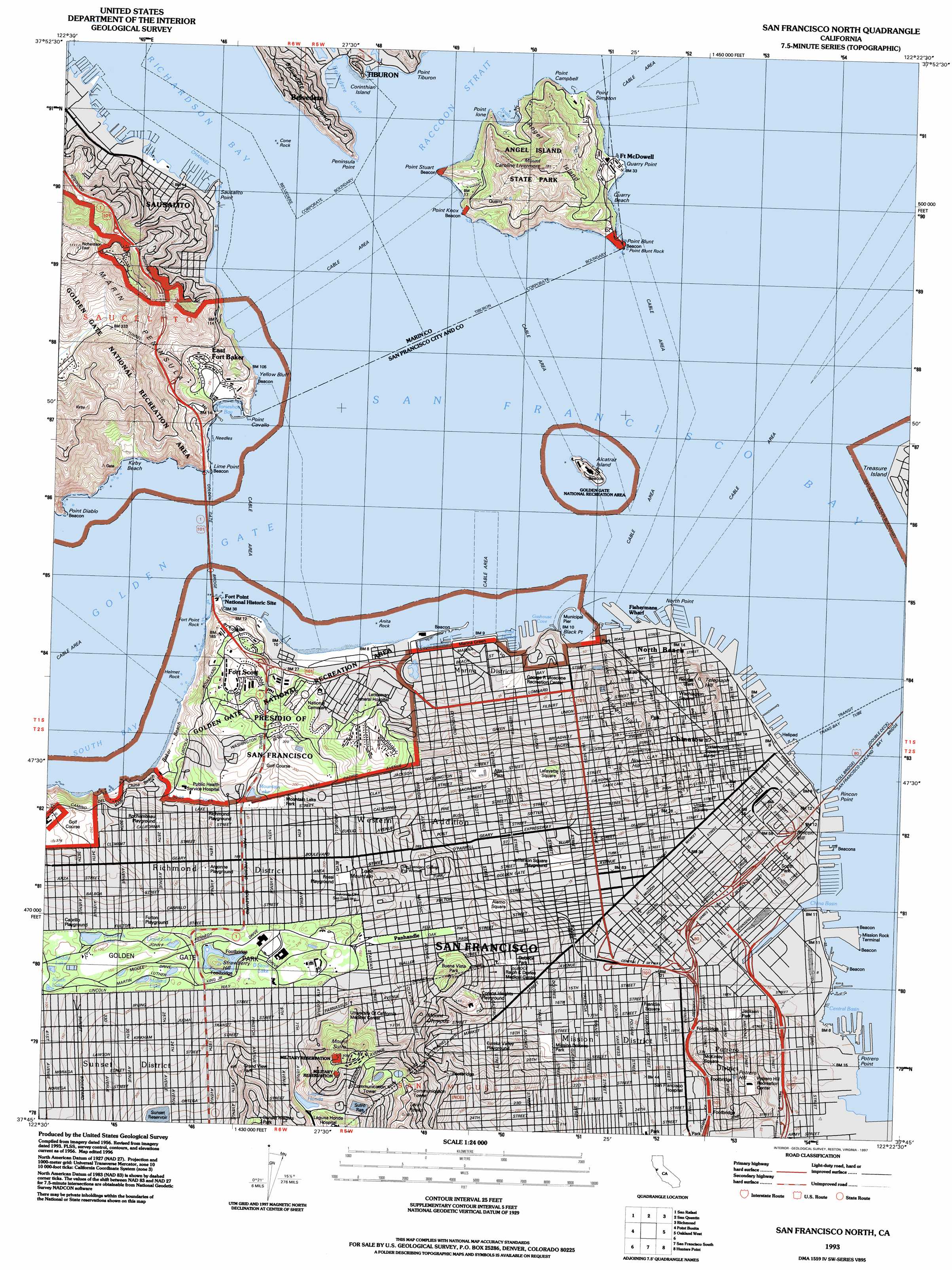
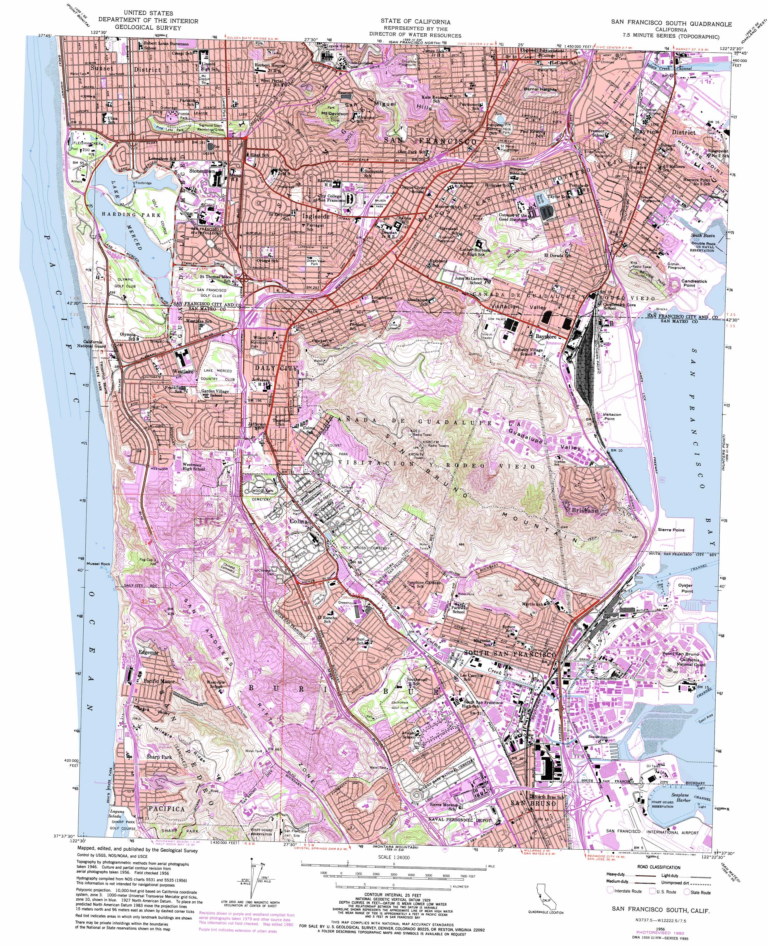
For this, I would study the USGS 1:24000 topographic maps, specifically the San Francisco north and south sheet. You might have to load them into a paint program but you should be able to outline the ridgeline and deduce the drainage from there. As far as drainage northward, you'll probably have to pick a point for what constitutes the Pacific and what constitutes the bay.
posted by crapmatic at 10:35 AM on August 1, 2012
posted by crapmatic at 10:35 AM on August 1, 2012
Best answer: Near the bottom of the first site jquinby linked is this lovely map of "Present-Day Drainages," which looks exactly like what you want.
posted by theodolite at 10:51 AM on August 1, 2012 [4 favorites]
posted by theodolite at 10:51 AM on August 1, 2012 [4 favorites]
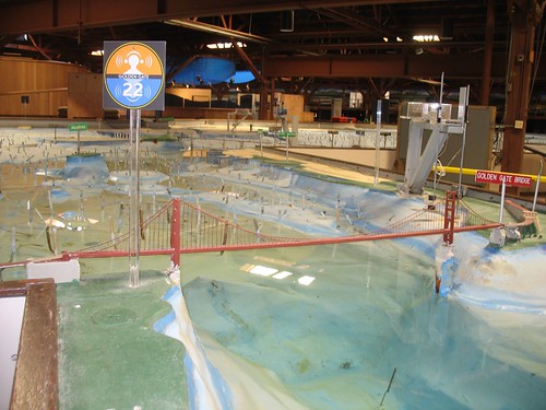
You sound like a person who would enjoy a visit to the Bay Model Visitor Center! The folks there will be able to answer you if you call, but the place itself is awesome (AWESOME!) and not to be missed.
posted by apparently at 12:40 PM on August 1, 2012 [2 favorites]
posted by apparently at 12:40 PM on August 1, 2012 [2 favorites]
The Bay Model is super cool, but it would actually be useless in solving this particular issue since it more or less omits the entire city of San Francisco itself and ignores land topography in general.
posted by theodolite at 1:16 PM on August 1, 2012
posted by theodolite at 1:16 PM on August 1, 2012
You want a watershed map. Scroll down for the very basic "Geology and Groundwater Basins" and even more straightforward "Present-Day Drainage Systems" to see the divide.
posted by oneirodynia at 5:21 PM on August 1, 2012
posted by oneirodynia at 5:21 PM on August 1, 2012
Oh oops, didn't see theodolite's answer.
posted by oneirodynia at 5:30 PM on August 1, 2012
posted by oneirodynia at 5:30 PM on August 1, 2012
I meant "the staff at the Bay model may be able to help you find an answer" and, separately, "their setup is super cool, especially to the sort of person who would pose a question about drainage in SF." Sorry I wasn't clear!
posted by apparently at 6:20 PM on August 1, 2012
posted by apparently at 6:20 PM on August 1, 2012
« Older What cognitive biases should everyone know? | Will Boston Ivy harm my stucco siding? Newer »
This thread is closed to new comments.
posted by k5.user at 10:27 AM on August 1, 2012