What kind of information is out there to make maps with in Illustrator?
November 4, 2010 5:51 PM Subscribe
What kind of information is out there that I can easily make a map out of in Illustrator?
I have to make a map of some kind in Illustrator, and I have illustrator's block or something. It can be anything, real or fictional, it can be as weird as you could think of.
I live in southern California, Long Beach specifically, and originally I was going to make a map of the LA metro train system, but try to do it in the style of Massimo Vignelli's NYC subway map, but the LA system is pretty non-complicated, unlike the one in Vignelli's map. I was thinking of doing another city with a complicated train system, like London or Moscow or something, but not really knowing the geography at all I think would make it difficult.
Other than that I'm thinking of making a map of crime in Long Beach, or walkability (using Walk Score), or maybe combining the two. The thing is I'll have to go through and manually adjust all the statistics for these things.
So I was wondering if there's some way to get access to spacial data that I can just import into Illustrator in some way. What information is out there? What could I get my hands on? What can I easily use with Illustrator?
Response by poster: That's a great idea! My teacher's okay with borrowing like that, just as long as I do enough work with the pieces I borrowed to show I didn't cut and paste a project together.
posted by malapropist at 6:07 PM on November 4, 2010
posted by malapropist at 6:07 PM on November 4, 2010
one thing you can try is uDig. it can import geodata in many formats, including shapefiles, and export them to some other formats, including vector. you can also use it to browse a database like postgis, though a db isn't required. cloudmade has lots of public domain data, but it's available pretty much everywhere.
posted by klanawa at 6:13 PM on November 4, 2010
posted by klanawa at 6:13 PM on November 4, 2010
So I was wondering if there's some way to get access to spacial data that I can just import into Illustrator in some way.
If you download GIS data, and want to import it into Illustrator to work with, I highly recommend MAPublisher. It's free for a 14-day trial. With it you might not even need a GIS program.
posted by The Biggest Dreamer at 6:56 PM on November 4, 2010
If you download GIS data, and want to import it into Illustrator to work with, I highly recommend MAPublisher. It's free for a 14-day trial. With it you might not even need a GIS program.
posted by The Biggest Dreamer at 6:56 PM on November 4, 2010
I personally love transit maps, so I think you should stick with the railroad idea! Here are some suggestions, in order of complexity (kind of):
-Amtrak (if you want a big project then include the rest of the national rail system)
-Washington Metro
-Montreal Metro
-NYC commuter rail: Metro North, LIRR
-MARTA (Atlanta)
-Bay Area: BART; MUNI Metro, trolleys, cable cars
-TTC (Toronto; Subway, streetcars)
posted by clorox at 1:26 AM on November 5, 2010 [1 favorite]
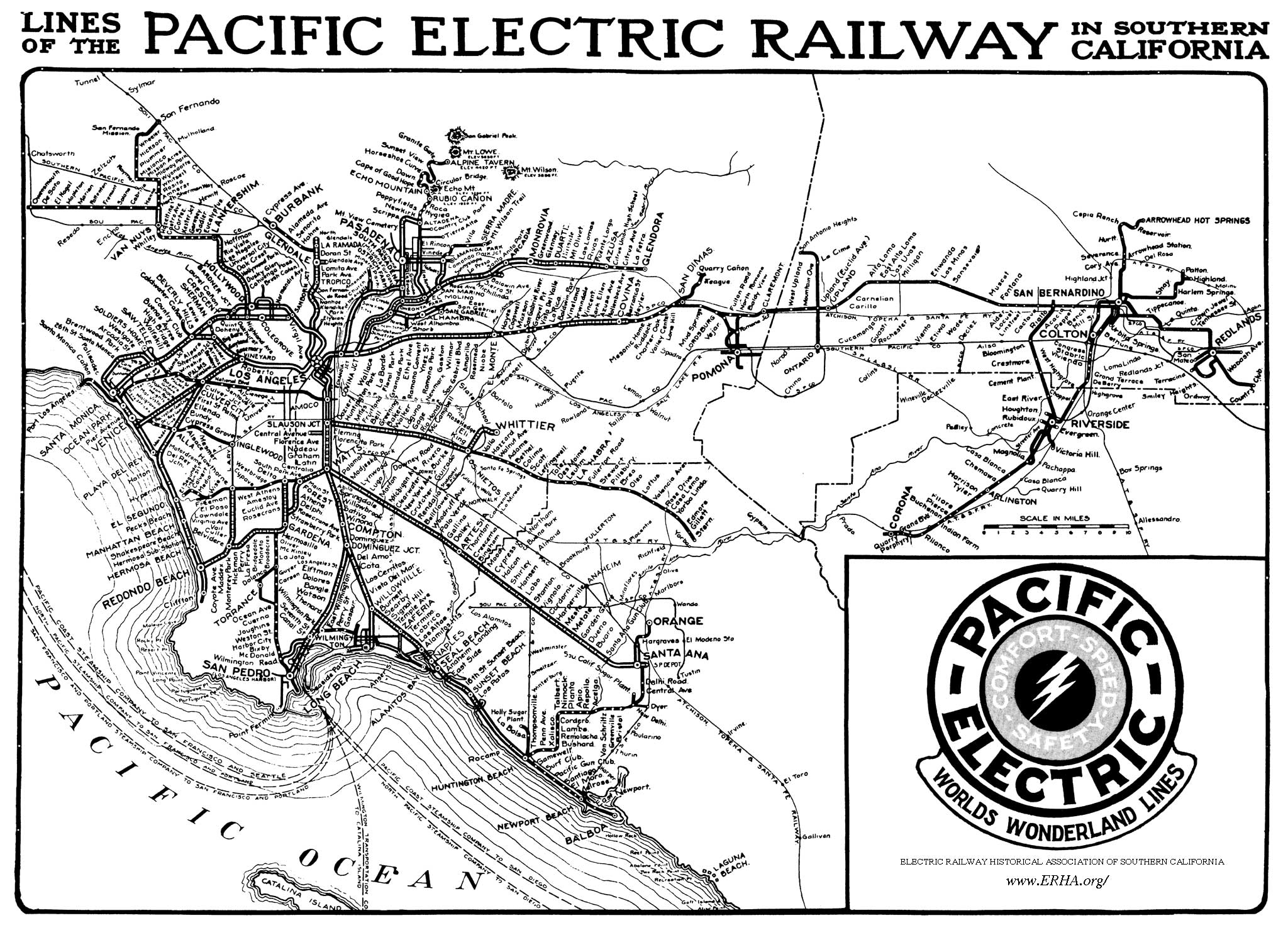
But if you want to stick with LA, how about the old Pacific Electric and Los Angeles railways?
posted by clorox at 1:35 AM on November 5, 2010
posted by clorox at 1:35 AM on November 5, 2010
This thread is closed to new comments.
but be sure to cite their data on your map.
posted by nanhey at 6:02 PM on November 4, 2010